Take charge of your next adventure with BaseCamp, software to view and organize your maps, waypoints, routes, and tracks and send them to your Garmin device.
Main Features:
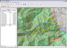
-View 24K or 100K topographic maps and other topographic data.
-Displays maps in 2-D or 3-D, including elevation profiles.
-View and rotate maps at any angle.
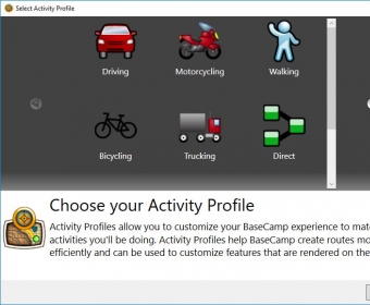
-Create waypoints and routes on your computer and transfer maps, waypoints, routes, tracks and geotagged photos between your computer and device.
-Transfers satellite images to your device (with the purchase of BirdsEye™ Satellite Imagery subscription).
-Shows animated playback of routes and tracks over time.
-Supports geotagged photos.
-Easily organize data into folders.
-Prints full-page, color maps.
-Exports user data for viewing in Google Earth™.


Comments (5)